
Tour du Mont Blanc
August 2018
Intro
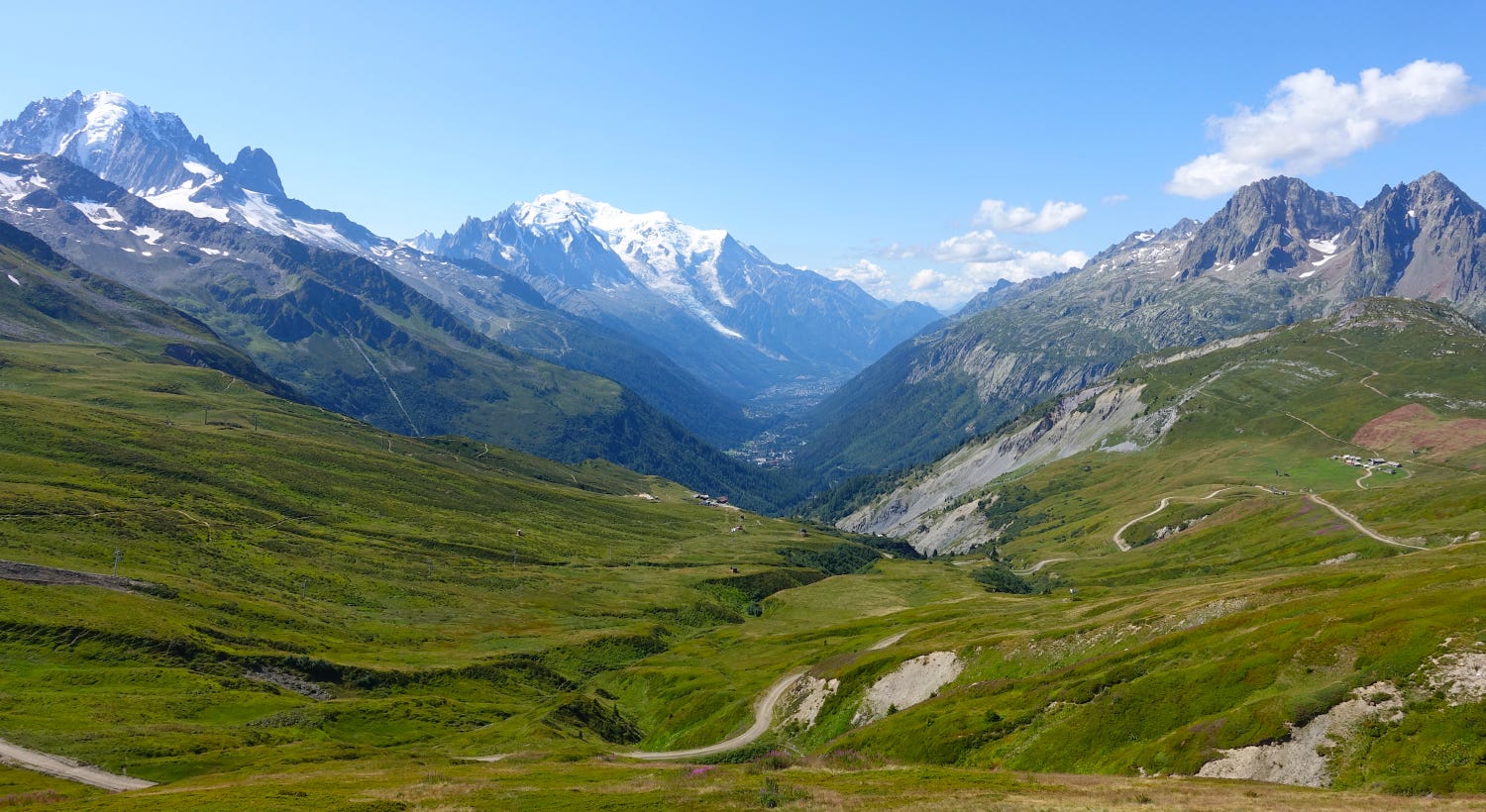
The Tour du Mont Blanc (TMB) is a hiking route that circumnavigates Mont Blanc, the highest mountain in the Alps, and goes through France, Italy, and Switzerland. It is considered one of the world’s most beautiful multi-day hikes and I absolutely agree.
In August 2018, I decided it was time to finally hike the TMB. It was a last minute decision as usual, but this time it was due to having to cancel prior hiking plans but still wanting to hike. Because it was high season and I had not prebooked any accommodation, I took my camping gear so I would have some flexibility in where to sleep, as most accommodations would likely be fully booked and there were campsites along most of the route. Below is a daily recap of my hike along with some closing thoughts and what I would do differently next time.
Stats
Dates: August 6 – August 16, 2018
Days: 9 hiking, 2 rest days (due to back injury)
Direction: 7 days counterclockwise, 2 days clockwise
Distance: 150 km (93 miles)
Elevation gain: 8.4k meters (27.5k feet)
Elevation loss: 10.2k meters (33.3k feet)
Average distance per day: 16.7 km (10.4 miles)
Average elevation gain per day: 931 meters (3055 feet)
Average elevation loss per day: 1129 meters (3704 feet)
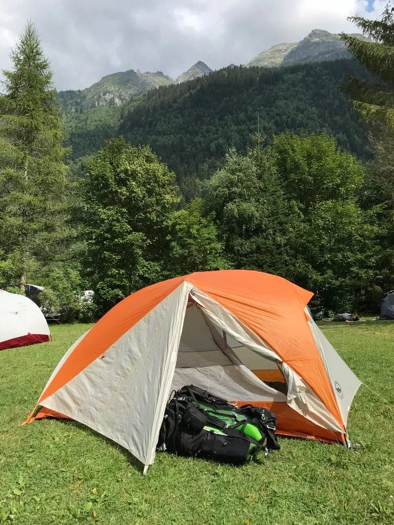
Overnights: camping 4 nights, refugio/hostel 8 nights
Nationalities: met hikers from 19 countriesDaily Recap
Day 0: August 5, 2018
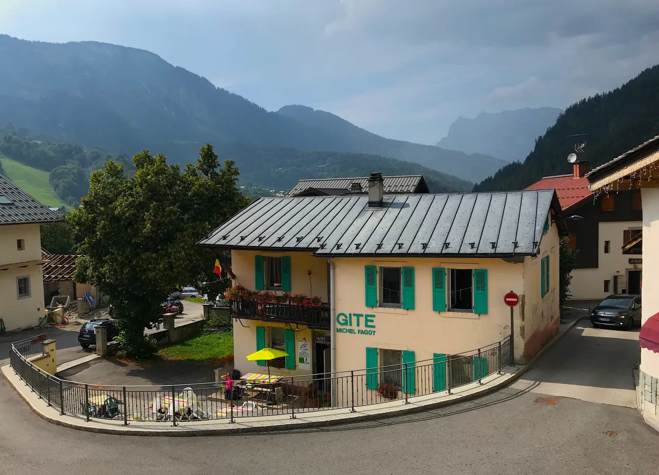
Overnight: Gîte Michel Fagot (50€ w/ dinner & breakfast)A whirlwind past few days. Thursday: booked flight (using miles) from the US to Geneva. Friday: lots of scrambling getting things ready. Saturday: flew to Geneva. Sunday: arrived Geneva, took Mountain Drop-offs shuttle to Les Houches, bought stove fuel and a map, and stayed overnight at Gite Michel Fagot. Tomorrow a new adventure begins!
Day 1: August 6, 2018
Distance: 16.2 km
Elevation gain: 700 m
Elevation loss: 1304 m
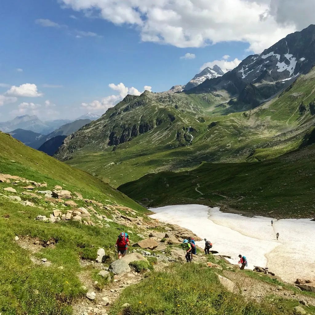
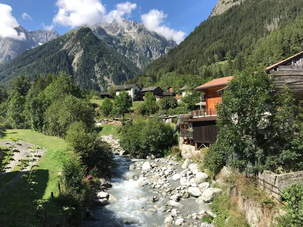
Overnight: Camping le Pontet (~10€ to camp)After talking with TMB guide Jose at the Gite last night, I took the Bellevue cable car from Les Houches. This meant skipping ~3 hours of uphill though the forest (with no views), but allowed me to hike the high pass route over Col de Tricot to Les Contamines (It would have been way too difficult for me to hike both the first climb from Les Houches and the high pass on the first day). This was the right decision! It was a beautiful but tough hike with perfect weather. A thunderstorm started just as I set up my tent for the night and heavy rain continued throughout the night.
Day 2: August 7, 2018
Distance: 17.1 km
Elevation gain: 1343 m
Elevation loss: 971 m
Overnight: Refuge des Mottets (47€ w/ dinner & breakfast)
A spectacular day, but holy, this is tough! I really wished I had trained on hills while carrying a heavy pack before I started. I was in Texas for 2 months before starting the TMB and with the extremely hot and humid weather coupled with flat terrain, all I managed to do beforehand was go on a few evening walks in a suburban neighborhood and walk around in indoor malls.
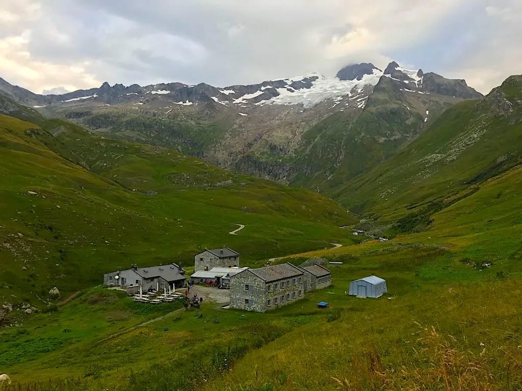
Today I hiked over Col du Bonhomme and Col de la Croix. It was quite crowded today on the trail. Guess I missed the crowds yesterday since I went over the high pass instead of the traditional route. There was a high pass option today over Col des Fours, but had to skip it as it was already late afternoon and thunderstorms were brewing over the pass. I managed to get a last minute bed at Refuge des Mottets, where we had a wonderful meal and incredible views.
Day 3: August 8, 2018
Distance: 19.8 km
Elevation gain: 1159 m
Elevation loss: 1128 m
Overnight: Gite le Randonneur du Mont Blanc (50€ w/ dinner & breakfast)
We started climbing as soon as we departed the refuge to Col de la Seigne, where we crossed from France into Italy, and had our first glimpse of Mont Blanc. Each day as we cross over a mountain pass, the scenery is just jaw dropping. Since I didn’t book any accommodations in advance, I’m constantly wondering where I’m going to sleep as there are limited campsites on this side of the mountain. I managed to get a bed at Gite le Randonneur du Mont Blanc for the night.
Day 4: August 9, 2018
Distance: 6.4 km
Elevation gain: 806 m
Elevation loss: 194 m
Overnight: Rifugio G. Bertone (50€ w/ dinner & breakfast)
I said goodbye to 3 Spanish hikers that I had been hiking with since the start, as they were going much further today and there was no availability in refuges and no campsites where they were going. It was great hiking with them and speaking Spanish the past 3 days. It made this adventure feel like my Camino walks last year. Funny enough, I ended up hiking the next 4 days with another Spanish couple that I met a couple of days ago.
Today was a short day with only 800 meters of climbing. We took the cable car down to the town of Courmayeur, Italy where we had lunch and then hiked up to Refugio Bertone. We managed to arrive just as heavy rain started. Glad I’m not camping tonight, but a little bitter that I’ve been carrying camping gear and food that I haven’t been using for the past 3 days.
Day 5: August 10, 2018
Distance: 26.2 km
Elevation gain: 1194 m
Elevation loss: 1476 m
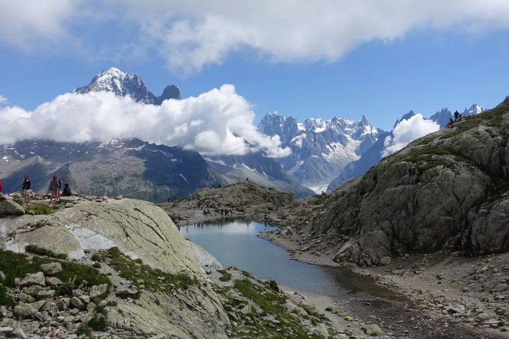
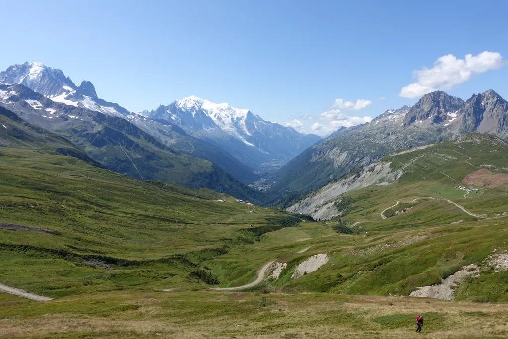
Overnight: Camping des Glaciers La Fouly (17 CHF to camp)A truly epic day: lush green valleys, glaciers for miles, sunshine, and good friends while hiking along Val Ferret. We then climbed over Grand Col Ferret, where we crossed from Italy into Switzerland. Then a long downhill to La Fouly, where we camped for the night under an impressive glacier. Each day I find myself saying that this was my favorite day. The scenery never disappoints. I finally feel like I have my hiking legs back, as I felt strong all day. I even managed to jog some of the flat and downhill sections, while carrying a full pack.
Day 6: August 11, 2018
Distance: 18.0 km
Elevation gain: 729 m
Elevation loss: 703 m
Overnight: Camping Relais d'Arpette (13 CHF to camp)
A fairly relaxing recovery day walking through tranquil Swiss villages. Today didn’t have the amazing views that I got accustomed to the past 5 days, but still beautiful. The final climb into Champex was nothing like the previous climbs, but my legs were quite tired after yesterday. I was so happy to finally reach the campground, where a bee stung me on the bottom of my foot while setting up camp. Ouch!
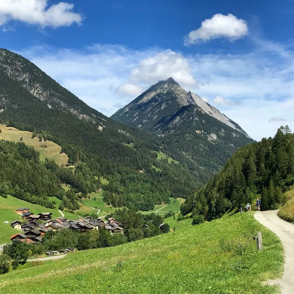
Day 7: August 12, 2018
Distance: 13.6 km
Elevation gain: 1043 m
Elevation loss: 1337 m
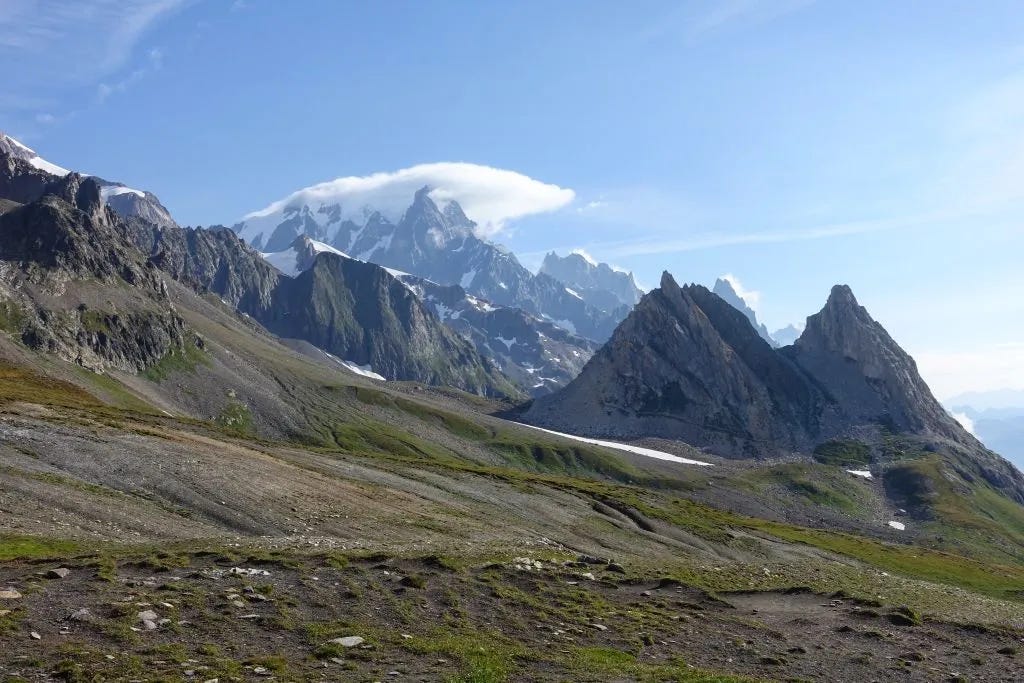
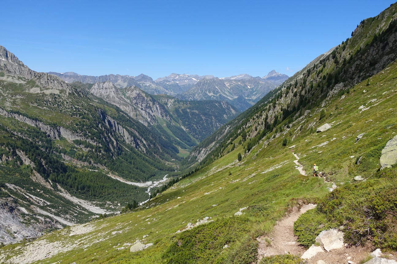
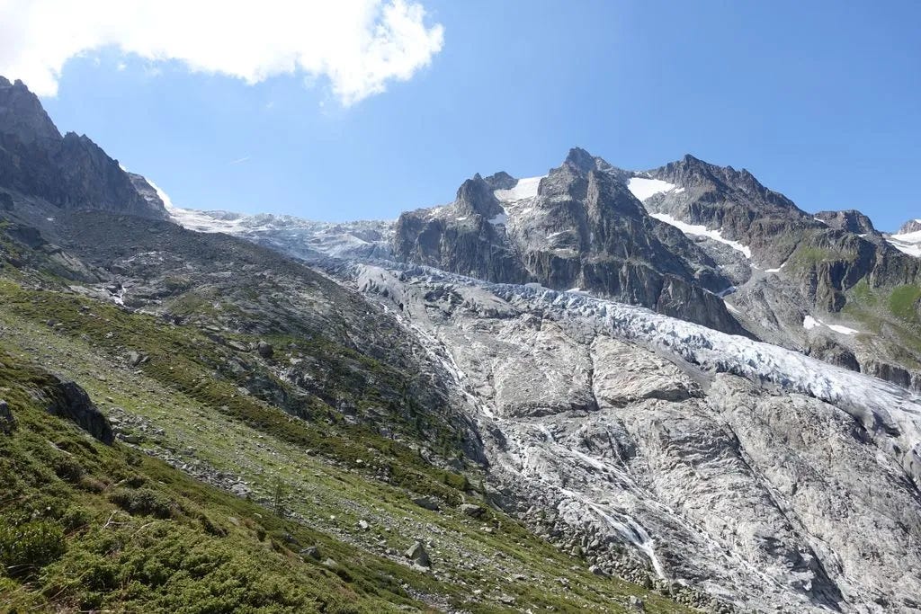
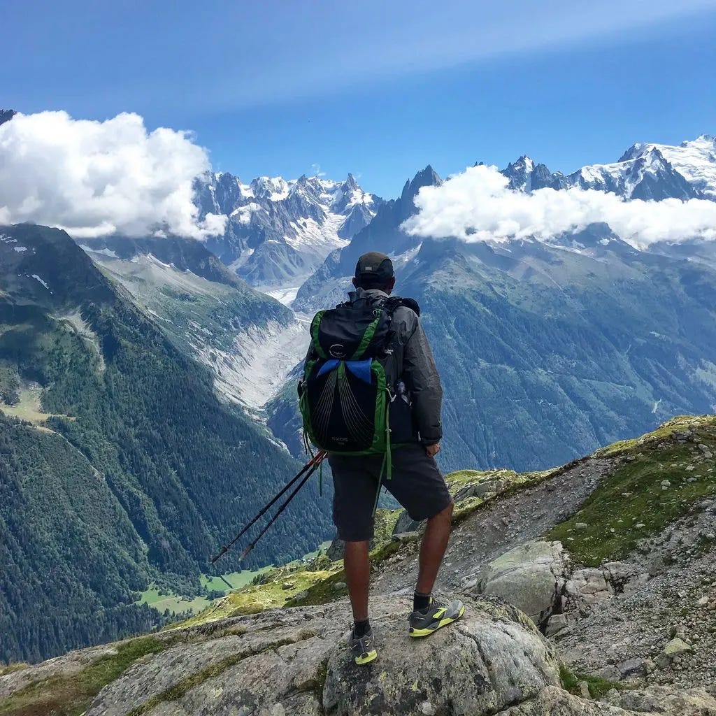
Overnight: Camping Le Peuty (4 CHF to camp)Today we hiked over the highest point of the TMB over Fenetre d’Arpette at 2665 meters. It was a tough steep climb and even tougher descent, made worthwhile with views of the Trient glacier. Today was the hardest day of the entire tour and I was exhausted when I reached the campsite at Le Peuty.
Day 8: August 15, 2018
Distance: 18.7 km
Elevation gain: 403 m
Elevation loss: 1975 m
Overnight: Auberge la Boërne (45€ w/ dinner & breakfast)
I ended up tweaking my back somehow when I was packing up the next morning after camping at Le Peuty. It was quite painful to carry my backpack, so I decided to take the bus and train back to Les Houches where I started to rest until my back hopefully recovered. The timing was good as it rained for those two days and I heard that it was quite cold with minimal visibility on the trail over those two days. I relaxed in Les Houches and Chamonix for 2 days and stayed at Gite Michel Fagot, where the staff was wonderful and supportive.
Today (day 8 of hiking, day 10 overall), the sunshine returned and I continued hiking. Instead of returning to where I had stopped, I decided to walk backwards (clockwise) towards where I stopped. The weather and scenery was spectacular. I hiked solo as the people I was hiking with had already finished their hike while I was resting. I visited the famed Lac Blanc, which was beautiful but incredibly crowded. When I reached Auberge la Boërne, I was lucky they had a bed available for me, as I did not have a reservation.
Day 9:
Date: August 16, 2018
Distance: 13.9 km
Elevation gain: 1004 m
Elevation loss: 1075 m
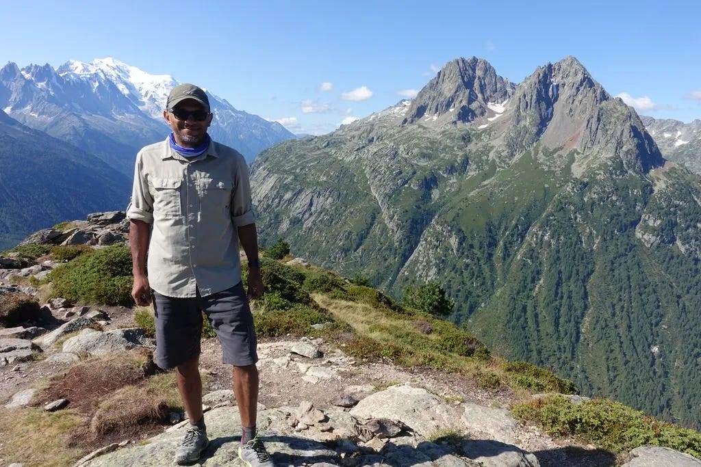
Overnight: Gîte Michel Fagot (50€ w/ dinner & breakfast)I continued clockwise hiking over Col du Balme and reached Le Peuty, where I stopped a few days earlier. Tour complete! Such an incredible experience with jaw dropping scenery every single day, lung busting climbs, knee wrecking descents, and wonderful people.
Closing Thoughts
The TMB is one of the most scenic multi-day hikes I have ever done. The scenery was the highlight for me and the primary reason for doing this tour. Because of its beauty, it is a very popular route. During the short optimal hiking season (late June to mid September), it is quite busy along most of the route, especially with the surge of day hikers close to Chamonix and Courmayeur.
This is not a wilderness hike. There are services (accommodation, restaurants, shops, water) along most of the route, which makes this route possible without carrying a lot of extra gear/food/water. It was essentially a series of tough day hikes over ~10 days.
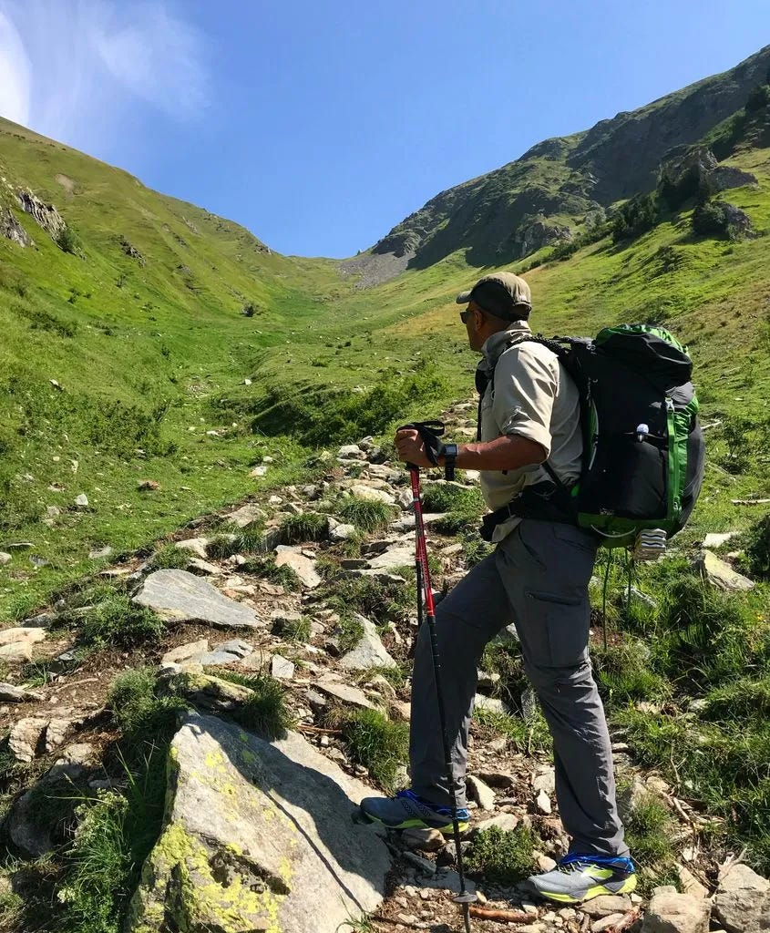
There is at least one mountain pass to climb and descend almost everyday. Most of the climbs are quite steep and difficult, but the descents are even tougher, especially on my knees. Hiking poles are essential. I really wished I had trained ahead of time. I finally started to feel stronger on day 4.
There are several high route variants throughout the tour, including Col de Tricot, Col des Fours, and Fenetre d’Arpette. I hiked Col de Tricot and Fenetre d’Arpette and they were tough but absolutely worth it. The high routes should only be attempted if the weather is expected to be good. I missed Col des Fours because when I arrived in the late afternoon, thunderstorms were starting to develop. If I hiked it again, I would try to hike Col des Fours and some of the other variants I didn’t do this time.
Clockwise vs Counter-clockwise: I am happy I hiked it counter clockwise for my first time, which is the ‘traditional’ more popular direction. If I were to hike the TMB again, I would do it clockwise to have a different experience. My last 2 days were clockwise and I enjoyed the relative quiet in the morning and late afternoon, as I would cross paths with the CCW hikers in the mid-afternoon around lunchtime.
I definitely want to hike more in the Mont Blanc region, whether the TMB again or other hiking circuits nearby, some of which overlap with the TMB. I met several hikers doing the GR5 from Lake Geneva (Lac Léman) to the Mediterranean. There is also the Haute Route from Chamonix to Zermatt. Both of these sound pretty amazing!
Camping vs Refugios
Most people that hike the TMB book all their accommodation well in advance, as space is limited and the season is relatively short. This makes for a trip without having to plan daily where to stay and eat, but also allows for less flexibility to adjust plans due to weather, injury, etc.
There were quite a few people that carried camping gear and had no advanced booking (or just a couple of places booked ahead of time). Most of the official campgrounds are essentially large fields with lots of tents stacked next to each other with bathrooms (and sometimes showers) nearby. If near a Refugio, there was also an option to buy meals. Wild camping is not generally permitted (each of the 3 countries has its own rules) but tolerated as long as hikers are discrete, setup at dusk, pack up at dawn, and leave no trace. I did not end up wild camping on my trip.
I carried camping gear because the trip came together quickly and I had not booked any accommodation in advance. I also wanted the flexibility of how far I hiked each day depending on weather, high route variants, how I felt, etc. After I tweaked my back, I was able to easily change my plan and rest for a couple of days and then continue. This would have been more challenging if I had prebooked all my accommodations.
I ended up camping half of the days and booking last minute at refugios the other half. The refugios were fun and social and worth the cost in my opinion. If I were to do TMB again, I would likely not camp and book most of my accommodation ahead of time, allowing me to carry a lightweight pack.
Resources
Below are a few resources that were helpful for me in planning and while on trail.
Guide Book – The most popular English guidebook for the TMB. I had it on my Kindle e-reader and on the Kindle app on my iPhone, which I preferred versus carrying a physical copy of the book. I would read each day’s route the night before to get an idea of what to expect.
KMZ Route file – For navigation while on trail, by far the best resource was the Organic Maps
maps.meapp loaded with the TMB KMZ file (it was posted to the FB group, thank you to whoever created it!). The KMZ file showed the route including the variants and most of the refugios and points of interest. I always knew where I was and how far (and elevation profile) to wherever I was going.Facebook group – good place to ask questions and see prior discussions. Everyone has the same questions so your questions are probably answered there already.
Paper map – I found it useful to get a good sense of the route, elevation profile, etc. You can buy in most of the towns for a few euros.